


Paris After Marville app for iPhone and iPad
Developer: Peter Sramek
First release : 11 Apr 2016
App size: 84.72 Mb
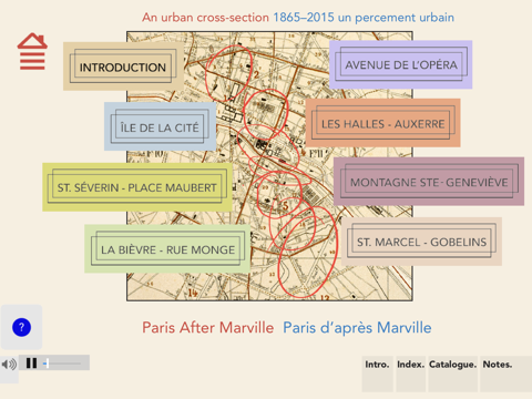
Explore the Paris of Haussmann and Napoleon III in photographs by Charles Marville. Compare how the sites look today as documented by Peter Sramek. Use historical maps to discover how streets have changed over 150 years. Connect to a live map to locate yourself when in Paris.
Includes:
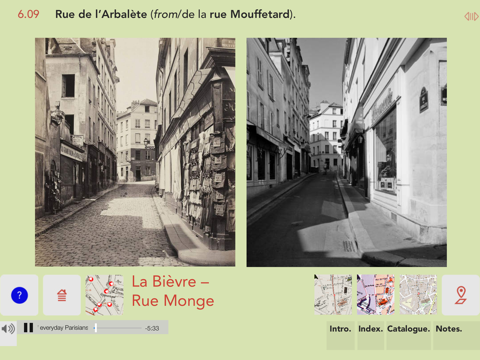
- Photographs of 183 locations;
- Offline, detailed images licensed from Agence Roger Viollet, the Musée Carnavalet and the Bibliothèque Historique de la Ville de Paris;
- English and French texts/ textes en français et anglais;
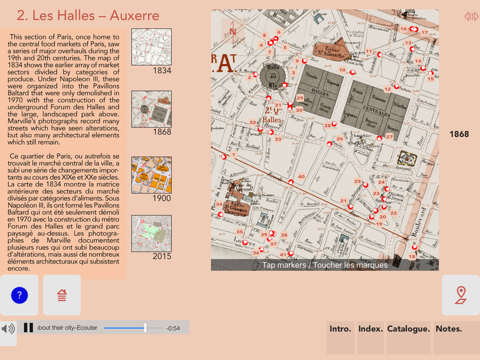
- Detailed maps from 1835, 1868, 1900 and 2015;
- Street sounds and audio commentaries by Parisians speaking about their city;
- Street index, museum catalogue information and notes about the photographic collection of Charles Marville;
- In-app link to a live locating map when connected to WiFi showing image locations and usable in Paris for navigation - live locating can cause considerable roaming charges unless you pre-load the Paris area map in G-Maps at which point WiFi is not needed;
Note: Please be patient with the initial download of high resolution image files. Once the application is loaded, you will only need a WiFi connection to use the live map window, all content will already be loaded.